March 23, 2003
MONO CLIFFS - 25th Sideroad
entrance (North side)
Meeting report by Nathan Burnett
Photos by Walter Muma
|
|
|
|
Today's hike started with a clear and sunny sky on a
beautiful spring day at the northern entrance into Mono Cliffs Provincial
Park located in southern Ontario just north of Orangeville. A few
newcomers joined our group as we set off in search of animal tracks and
signs. The theme of tracking was loosely based as the snow was melting
rapidly, making it very hard to track animals in such a "rough
substrate".
|
|
|
|
|
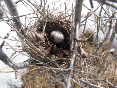
We started up the trail noticing a clear field with
first signs of plants beginning to emerge from their winter dorm. Up
the trail we saw a few birds nests (One with an egg from last year
still in it - and there was a small round hole in the egg) and tracks and scat belonging to a local Coyote.
|
|
|
|
|
|
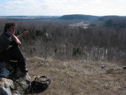
We followed the path up towards "Northern
Outlook". At the top of the outlook we stopped for lunch. Here
we shared stories and knowledge about the animals and plants that
live in the nearby surroundings. A raven was heard far off to the
south. The view from Northern Outlook is magnificent.
After lunch some of the group took part in a little
snowball fight. Nearby under a cedar, one of the group members found
an old and rotted opossum kill site. The characteristic bald hands
and tail was a dead giveaway as well as the stern snout. |
|
|
|
|
|
|
|
 |
Continuing down the trail we found several signs of
foxes and coyotes.
At McCarston's Lake a few of us ventured out onto the
melting ice to take a closer look at the signs of spring.
|
|
|
|
|
|
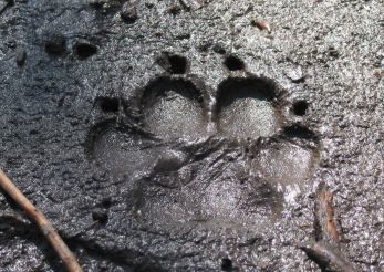
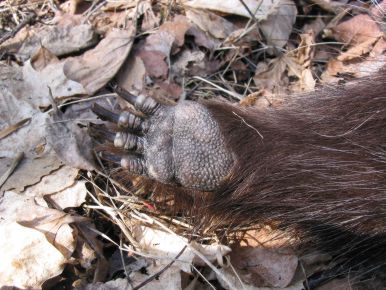
As the group left
McCarston's Lake we began to split up. One group found a porcupine
that had died of an unknown cause just off the trail. Here's a photo
of one of its paws. Meanwhile, the other group found a
tattered cottontail that had died of an unknown cause as well. Possible
Raven mating behaviour was observed by one person, but we cannot be
totally sure. |
|
|
|
|
|
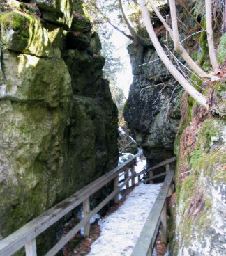
Stairs leading down through the rock formations left us
in amazement. Its really hard to believe an ice age glacier ripped
through what we now know to be the Niagara Escarpment.
|
|
|
|
|
We began to circle back towards the trailhead and more
knowledge was shared within the group. Time and time again Walter's trusty
Map came in handy. Back on the main trail we walked back to the road and
out of the park.
A great time was had by all, and we wish to thank everyone
for coming out and we look forward to seeing each of you again on our next
hike.
Happy Hiking,
Orangeville Trackers.
|
|
|
|
|
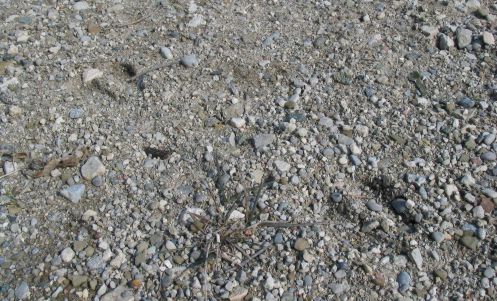
Deer tracks in the parking lot.
Wait a minute! Are those really deer
tracks???
For more info about these tracks, please see
Tracking Quizzes on the
Wildwood
Tracking website
(Quiz
#19).
|
|
| |
| |


